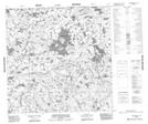
Maps showing William Wright Lake, 126-1E, Manitoba
William Wright Lake is a Lake located in 126-1E, Manitoba.
- Latitude: 59° 55' 3'' North (decimal: 59.9175000)
- Longitude: 97° 26' 36'' West (decimal: -97.4432999)
- Topography Feature Category: Lake
- Geographical Feature: Lake
- Canadian Province/Territory: Manitoba
- Location: 126-1E
- Atlas of Canada Locator Map: William Wright Lake
- GPS Coordinate Locator Map: William Wright Lake Lat/Long
William Wright Lake NTS Map Sheets