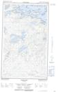
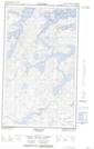
Maps showing Markle Island, 54-20E, Manitoba
Markle Island is a Island located in 54-20E, Manitoba.
- Latitude: 53° 42' 40'' North (decimal: 53.7111000)
- Longitude: 94° 33' 37'' West (decimal: -94.5602999)
- Topography Feature Category: Island
- Geographical Feature: Island
- Canadian Province/Territory: Manitoba
- Location: 54-20E
- Atlas of Canada Locator Map: Markle Island
- GPS Coordinate Locator Map: Markle Island Lat/Long
Markle Island NTS Map Sheets