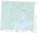
Maps showing Big Island Lake, 15 - 66 - 29W, Manitoba
Big Island Lake is a Unincorporated area located in 15 - 66 - 29W, Manitoba.
- Latitude: 54° 42' 21'' North (decimal: 54.7058000)
- Longitude: 101° 45' 46'' West (decimal: -101.7627999)
- Topography Feature Category: Unincorporated area
- Geographical Feature: Locality
- Canadian Province/Territory: Manitoba
- Location: 15 - 66 - 29W
- Atlas of Canada Locator Map: Big Island Lake
- GPS Coordinate Locator Map: Big Island Lake Lat/Long
Big Island Lake NTS Map Sheets