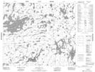
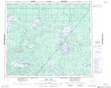
Maps showing Wallace McKay Island, 63-4E, Manitoba
Wallace McKay Island is a Island located in 63-4E, Manitoba.
- Latitude: 54° 25' 12'' North (decimal: 54.4200000)
- Longitude: 93° 26' 33'' West (decimal: -93.4425000)
- Topography Feature Category: Island
- Geographical Feature: Island
- Canadian Province/Territory: Manitoba
- Location: 63-4E
- Atlas of Canada Locator Map: Wallace McKay Island
- GPS Coordinate Locator Map: Wallace McKay Island Lat/Long
Wallace McKay Island NTS Map Sheets