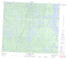
Maps showing Blyth Island, 82-28W, Manitoba
Blyth Island is a Island located in 82-28W, Manitoba.
- Latitude: 56° 6' 5'' North (decimal: 56.1014000)
- Longitude: 101° 45' 7'' West (decimal: -101.7518999)
- Topography Feature Category: Island
- Geographical Feature: Island
- Canadian Province/Territory: Manitoba
- Location: 82-28W
- Atlas of Canada Locator Map: Blyth Island
- GPS Coordinate Locator Map: Blyth Island Lat/Long
Blyth Island NTS Map Sheets