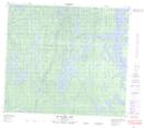
Maps showing Marshall Island, 83-26W, Manitoba
Marshall Island is a Island located in 83-26W, Manitoba.
- Latitude: 56° 10' 30'' North (decimal: 56.1750000)
- Longitude: 101° 32' 00'' West (decimal: -101.5333000)
- Topography Feature Category: Island
- Geographical Feature: Island
- Canadian Province/Territory: Manitoba
- Location: 83-26W
- Atlas of Canada Locator Map: Marshall Island
- GPS Coordinate Locator Map: Marshall Island Lat/Long
Marshall Island NTS Map Sheets