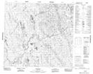
Maps showing Herman Taylor Creek, 96-20E, Manitoba
Herman Taylor Creek is a River located in 96-20E, Manitoba.
- Latitude: 57° 18' 57'' North (decimal: 57.3157999)
- Longitude: 94° 20' 58'' West (decimal: -94.3494000)
- Topography Feature Category: River
- Geographical Feature: Creek
- Canadian Province/Territory: Manitoba
- Location: 96-20E
- Atlas of Canada Locator Map: Herman Taylor Creek
- GPS Coordinate Locator Map: Herman Taylor Creek Lat/Long