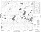
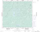
Maps showing Wesley Wilson Bay, 71-6E2, Manitoba
Wesley Wilson Bay is a Bay located in 71-6E2, Manitoba.
- Latitude: 55° 9' 44'' North (decimal: 55.1621999)
- Longitude: 93° 8' 29'' West (decimal: -93.1414000)
- Topography Feature Category: Bay
- Geographical Feature: Bay
- Canadian Province/Territory: Manitoba
- Location: 71-6E2
- Atlas of Canada Locator Map: Wesley Wilson Bay
- GPS Coordinate Locator Map: Wesley Wilson Bay Lat/Long
Wesley Wilson Bay NTS Map Sheets