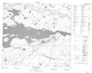
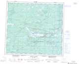
Maps showing Hudson Point, 85-17E, Manitoba
Hudson Point is a Cape located in 85-17E, Manitoba.
- Latitude: 56° 24' 28'' North (decimal: 56.4078000)
- Longitude: 94° 55' 15'' West (decimal: -94.9208000)
- Topography Feature Category: Cape
- Geographical Feature: Point
- Canadian Province/Territory: Manitoba
- Location: 85-17E
- Atlas of Canada Locator Map: Hudson Point
- GPS Coordinate Locator Map: Hudson Point Lat/Long
Hudson Point NTS Map Sheets