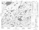
Maps showing Dyer Lake, 61-23E, Manitoba
Dyer Lake is a Lake located in 61-23E, Manitoba.
- Latitude: 54° 14' 41'' North (decimal: 54.2446999)
- Longitude: 94° 5' 44'' West (decimal: -94.0956000)
- Topography Feature Category: Lake
- Geographical Feature: Lake
- Canadian Province/Territory: Manitoba
- Location: 61-23E
- Atlas of Canada Locator Map: Dyer Lake
- GPS Coordinate Locator Map: Dyer Lake Lat/Long
Dyer Lake NTS Map Sheets