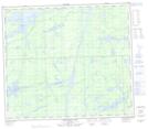
Maps showing Charles Bay, 78-6E, Manitoba
Charles Bay is a Bay located in 78-6E, Manitoba.
- Latitude: 55° 43' 56'' North (decimal: 55.7321999)
- Longitude: 96° 37' 0'' West (decimal: -96.6166999)
- Topography Feature Category: Bay
- Geographical Feature: Bay
- Canadian Province/Territory: Manitoba
- Location: 78-6E
- Atlas of Canada Locator Map: Charles Bay
- GPS Coordinate Locator Map: Charles Bay Lat/Long
Charles Bay NTS Map Sheets