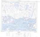
Maps showing Collins Narrows, 56-23E, Manitoba
Collins Narrows is a Channel located in 56-23E, Manitoba.
- Latitude: 53° 51' 52'' North (decimal: 53.8644000)
- Longitude: 94° 7' 45'' West (decimal: -94.1292000)
- Topography Feature Category: Channel
- Geographical Feature: Narrows
- Canadian Province/Territory: Manitoba
- Location: 56-23E
- Atlas of Canada Locator Map: Collins Narrows
- GPS Coordinate Locator Map: Collins Narrows Lat/Long
Collins Narrows NTS Map Sheets