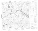
Maps showing Alexander Thomson Island, Manitoba
Alexander Thomson Island is a Island located in Manitoba.
- Latitude: 58° 53' 32'' North (decimal: 58.8921999)
- Longitude: 96° 19' 31'' West (decimal: -96.3252999)
- Topography Feature Category: Island
- Geographical Feature: Island
- Canadian Province/Territory: Manitoba
- GPS Coordinate Locator Map: Alexander Thomson Island Lat/Long
Alexander Thomson Island NTS Map Sheets