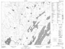
Maps showing Jones Point, 69-10W, Manitoba
Jones Point is a Cape located in 69-10W, Manitoba.
- Latitude: 55° 0' 39'' North (decimal: 55.0108000)
- Longitude: 98° 56' 29'' West (decimal: -98.9413999)
- Topography Feature Category: Cape
- Geographical Feature: Point
- Canadian Province/Territory: Manitoba
- Location: 69-10W
- Atlas of Canada Locator Map: Jones Point
- GPS Coordinate Locator Map: Jones Point Lat/Long
Jones Point NTS Map Sheets