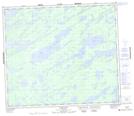
Maps showing Sanders Island, 74-8E, Manitoba
Sanders Island is a Island located in 74-8E, Manitoba.
- Latitude: 55° 22' 39'' North (decimal: 55.3774999)
- Longitude: 96° 18' 18'' West (decimal: -96.3050000)
- Topography Feature Category: Island
- Geographical Feature: Island
- Canadian Province/Territory: Manitoba
- Location: 74-8E
- Atlas of Canada Locator Map: Sanders Island
- GPS Coordinate Locator Map: Sanders Island Lat/Long