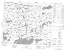
Maps showing Baker Island, 61-12E, Manitoba
Baker Island is a Island located in 61-12E, Manitoba.
- Latitude: 54° 17' 17'' North (decimal: 54.2880999)
- Longitude: 95° 43' 6'' West (decimal: -95.7182999)
- Topography Feature Category: Island
- Geographical Feature: Island
- Canadian Province/Territory: Manitoba
- Location: 61-12E
- Atlas of Canada Locator Map: Baker Island
- GPS Coordinate Locator Map: Baker Island Lat/Long
Baker Island NTS Map Sheets