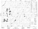
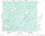
Maps showing Phillips Rapids, 67-10E2, Manitoba
Phillips Rapids is a Rapids located in 67-10E2, Manitoba.
- Latitude: 54° 49' 14'' North (decimal: 54.8205999)
- Longitude: 92° 31' 7'' West (decimal: -92.5185999)
- Topography Feature Category: Rapids
- Geographical Feature: Rapids
- Canadian Province/Territory: Manitoba
- Location: 67-10E2
- Atlas of Canada Locator Map: Phillips Rapids
- GPS Coordinate Locator Map: Phillips Rapids Lat/Long
Phillips Rapids NTS Map Sheets