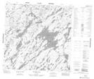
Maps showing Alan Johnston Bay, 120-24W, Manitoba
Alan Johnston Bay is a Bay located in 120-24W, Manitoba.
- Latitude: 59° 25' 29'' North (decimal: 59.4247000)
- Longitude: 101° 31' 40'' West (decimal: -101.5277999)
- Topography Feature Category: Bay
- Geographical Feature: Bay
- Canadian Province/Territory: Manitoba
- Location: 120-24W
- Atlas of Canada Locator Map: Alan Johnston Bay
- GPS Coordinate Locator Map: Alan Johnston Bay Lat/Long
Alan Johnston Bay NTS Map Sheets