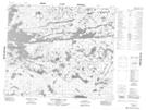
Maps showing McRae Peninsula, 57 - 13E, Manitoba
McRae Peninsula is a Cape located in 57 - 13E, Manitoba.
- Latitude: 53° 55' 31'' North (decimal: 53.9252999)
- Longitude: 95° 38' 53'' West (decimal: -95.6480999)
- Topography Feature Category: Cape
- Geographical Feature: Peninsula
- Canadian Province/Territory: Manitoba
- Location: 57 - 13E
- Atlas of Canada Locator Map: McRae Peninsula
- GPS Coordinate Locator Map: McRae Peninsula Lat/Long
McRae Peninsula NTS Map Sheets