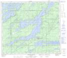
Maps showing Cote Island, 74-4-W, Manitoba
Cote Island is a Island located in 74-4-W, Manitoba.
- Latitude: 55° 26' 14'' North (decimal: 55.4371999)
- Longitude: 97° 56' 52'' West (decimal: -97.9477999)
- Topography Feature Category: Island
- Geographical Feature: Island
- Canadian Province/Territory: Manitoba
- Location: 74-4-W
- GPS Coordinate Locator Map: Cote Island Lat/Long
Cote Island NTS Map Sheets