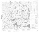
Maps showing Avery Collins Lake, 116-3E, Manitoba
Avery Collins Lake is a Lake located in 116-3E, Manitoba.
- Latitude: 59° 3' 29'' North (decimal: 59.0581000)
- Longitude: 96° 58' 12'' West (decimal: -96.9699999)
- Topography Feature Category: Lake
- Geographical Feature: Lake
- Canadian Province/Territory: Manitoba
- Location: 116-3E
- Atlas of Canada Locator Map: Avery Collins Lake
- GPS Coordinate Locator Map: Avery Collins Lake Lat/Long
Avery Collins Lake NTS Map Sheets