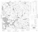
Maps showing Blair Bay, 116-1E, Manitoba
Blair Bay is a Bay located in 116-1E, Manitoba.
- Latitude: 59° 2' 24'' North (decimal: 59.0399999)
- Longitude: 97° 20' 35'' West (decimal: -97.3430999)
- Topography Feature Category: Bay
- Geographical Feature: Bay
- Canadian Province/Territory: Manitoba
- Location: 116-1E
- Atlas of Canada Locator Map: Blair Bay
- GPS Coordinate Locator Map: Blair Bay Lat/Long
Blair Bay NTS Map Sheets