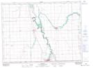
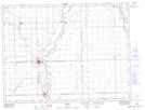
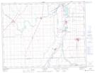
Maps showing Lord Selkirk Highway, St. Agathe, Manitoba
Lord Selkirk Highway is a Road feature located in St. Agathe, Manitoba.
- Latitude: 49° 26' 23'' North (decimal: 49.4396999)
- Longitude: 97° 17' 26'' West (decimal: -97.2906000)
- Topography Feature Category: Road feature
- Geographical Feature: Highway
- Canadian Province/Territory: Manitoba
- Location: St. Agathe
- Atlas of Canada Locator Map: Lord Selkirk Highway
- GPS Coordinate Locator Map: Lord Selkirk Highway Lat/Long
Lord Selkirk Highway NTS Map Sheets