Maps showing Neso Lake Provincial Park, 65 - 28W, Manitoba
Neso Lake Provincial Park is a Conservation area located in 65 - 28W, Manitoba.
- Latitude: 54° 39' 26'' North (decimal: 54.6571999)
- Longitude: 101° 32' 49'' West (decimal: -101.5468999)
- Topography Feature Category: Conservation area
- Geographical Feature: Provincial Park
- Canadian Province/Territory: Manitoba
- Location: 65 - 28W
- Atlas of Canada Locator Map: Neso Lake Provincial Park
- GPS Coordinate Locator Map: Neso Lake Provincial Park Lat/Long
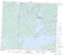
Neso Lake Provincial Park NTS Map Sheets