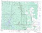
Maps showing Springwater Provincial Park, 33 - 23W, Manitoba
Springwater Provincial Park is a Conservation area located in 33 - 23W, Manitoba.
- Latitude: 51° 51' 30'' North (decimal: 51.8583000)
- Longitude: 100° 35' 19'' West (decimal: -100.5886000)
- Topography Feature Category: Conservation area
- Geographical Feature: Provincial Park
- Canadian Province/Territory: Manitoba
- Location: 33 - 23W
- Atlas of Canada Locator Map: Springwater Provincial Park
- GPS Coordinate Locator Map: Springwater Provincial Park Lat/Long
Springwater Provincial Park NTS Map Sheets