Maps showing Caribou River Park Reserve, 122 - 5E, Manitoba
Caribou River Park Reserve is a Conservation area located in 122 - 5E, Manitoba.
- Latitude: 59° 33' 49'' North (decimal: 59.5635999)
- Longitude: 96° 39' 40'' West (decimal: -96.6610999)
- Topography Feature Category: Conservation area
- Geographical Feature: Provincial Park
- Canadian Province/Territory: Manitoba
- Location: 122 - 5E
- Atlas of Canada Locator Map: Caribou River Park Reserve
- GPS Coordinate Locator Map: Caribou River Park Reserve Lat/Long
Caribou River Park Reserve NTS Map Sheets
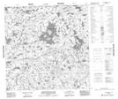
054M04 Warner Lake Topographic Map at 1:50,000 scale
054M05 Gross Lake Topographic Map at 1:50,000 scale
054M10 Catton Lake Topographic Map at 1:50,000 scale
054M12 Mcewen Lake Topographic Map at 1:50,000 scale
054M13 Mikolash Lake Topographic Map at 1:50,000 scale
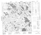
064P01 Hebner Lake Topographic Map at 1:50,000 scale
064P02 Kesselman Lake Topographic Map at 1:50,000 scale
064P03 Sellar Lake Topographic Map at 1:50,000 scale
064P05 Little Duck Lake Topographic Map at 1:50,000 scale
064P06 Fallis Lake Topographic Map at 1:50,000 scale
064P07 Wallbridge Lake Topographic Map at 1:50,000 scale
064P08 Caribou Lake Topographic Map at 1:50,000 scale
064P09 Kellas Lake Topographic Map at 1:50,000 scale
064P10 Adam Creek Topographic Map at 1:50,000 scale
064P11 Abbott Lake Topographic Map at 1:50,000 scale
064P12 Hollowrock Island Topographic Map at 1:50,000 scale
064P14 Commonwealth Lake Topographic Map at 1:50,000 scale
064P15 Vickery Lake Topographic Map at 1:50,000 scale
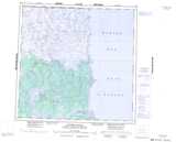
054M Caribou River Topographic Map at 1:250,000 scale
064P Nejanilini Lake Topographic Map at 1:250,000 scale