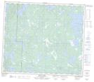
Maps showing Little Mikes Creek, 70 - 27W, Manitoba
Little Mikes Creek is a River located in 70 - 27W, Manitoba.
- Latitude: 55° 6' 45'' North (decimal: 55.1125000)
- Longitude: 101° 33' 22'' West (decimal: -101.5560999)
- Topography Feature Category: River
- Geographical Feature: Creek
- Canadian Province/Territory: Manitoba
- Location: 70 - 27W
- Atlas of Canada Locator Map: Little Mikes Creek
- GPS Coordinate Locator Map: Little Mikes Creek Lat/Long
Little Mikes Creek NTS Map Sheets