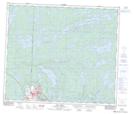
Maps showing Mills Island, 68 - 27W, Manitoba
Mills Island is a Island located in 68 - 27W, Manitoba.
- Latitude: 54° 51' 52'' North (decimal: 54.8643999)
- Longitude: 101° 32' 42'' West (decimal: -101.5450000)
- Topography Feature Category: Island
- Geographical Feature: Island
- Canadian Province/Territory: Manitoba
- Location: 68 - 27W
- Atlas of Canada Locator Map: Mills Island
- GPS Coordinate Locator Map: Mills Island Lat/Long
Mills Island NTS Map Sheets