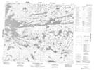
Maps showing Sanderson Bay, 56 - 11E, Manitoba
Sanderson Bay is a Bay located in 56 - 11E, Manitoba.
- Latitude: 53° 51' 15'' North (decimal: 53.8542000)
- Longitude: 95° 56' 31'' West (decimal: -95.9419000)
- Topography Feature Category: Bay
- Geographical Feature: Bay
- Canadian Province/Territory: Manitoba
- Location: 56 - 11E
- Atlas of Canada Locator Map: Sanderson Bay
- GPS Coordinate Locator Map: Sanderson Bay Lat/Long
Sanderson Bay NTS Map Sheets