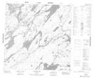
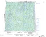
Maps showing McRae Hill, 122 - 20W, Manitoba
McRae Hill is a Mountain located in 122 - 20W, Manitoba.
- Latitude: 59° 34' 2'' North (decimal: 59.5671999)
- Longitude: 100° 52' 38'' West (decimal: -100.8772000)
- Topography Feature Category: Mountain
- Geographical Feature: Hill
- Canadian Province/Territory: Manitoba
- Location: 122 - 20W
- Atlas of Canada Locator Map: McRae Hill
- GPS Coordinate Locator Map: McRae Hill Lat/Long
McRae Hill NTS Map Sheets