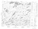
Maps showing Morris Rapids, 60 - 12E, Manitoba
Morris Rapids is a Rapids located in 60 - 12E, Manitoba.
- Latitude: 54° 9' 58'' North (decimal: 54.1661000)
- Longitude: 95° 44' 53'' West (decimal: -95.7481000)
- Topography Feature Category: Rapids
- Geographical Feature: Rapids
- Canadian Province/Territory: Manitoba
- Location: 60 - 12E
- Atlas of Canada Locator Map: Morris Rapids
- GPS Coordinate Locator Map: Morris Rapids Lat/Long
Morris Rapids NTS Map Sheets