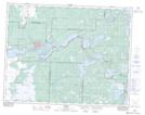
Maps showing Upper Pinawa Channel, 11 - 14 - 12E, Manitoba
Upper Pinawa Channel is a River located in 11 - 14 - 12E, Manitoba.
- Latitude: 50° 9' 32'' North (decimal: 50.1589000)
- Longitude: 95° 51' 8'' West (decimal: -95.8522000)
- Topography Feature Category: River
- Geographical Feature: Channel
- Canadian Province/Territory: Manitoba
- Location: 11 - 14 - 12E
- Atlas of Canada Locator Map: Upper Pinawa Channel
- GPS Coordinate Locator Map: Upper Pinawa Channel Lat/Long
Upper Pinawa Channel NTS Map Sheets