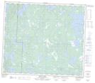
Maps showing Ernie Leech Island, 72 - 27W, Manitoba
Ernie Leech Island is a Island located in 72 - 27W, Manitoba.
- Latitude: 55° 11' 59'' North (decimal: 55.1996999)
- Longitude: 101° 30' 36'' West (decimal: -101.5100000)
- Topography Feature Category: Island
- Geographical Feature: Island
- Canadian Province/Territory: Manitoba
- Location: 72 - 27W
- Atlas of Canada Locator Map: Ernie Leech Island
- GPS Coordinate Locator Map: Ernie Leech Island Lat/Long
Ernie Leech Island NTS Map Sheets