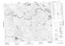
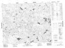
Maps showing Long Haul Lake, 38 - 10E, Manitoba
Long Haul Lake is a Lake located in 38 - 10E, Manitoba.
- Latitude: 52° 14' 27'' North (decimal: 52.2408000)
- Longitude: 96° 8' 47'' West (decimal: -96.1463999)
- Topography Feature Category: Lake
- Geographical Feature: Lake
- Canadian Province/Territory: Manitoba
- Location: 38 - 10E
- Atlas of Canada Locator Map: Long Haul Lake
- GPS Coordinate Locator Map: Long Haul Lake Lat/Long
Long Haul Lake NTS Map Sheets