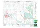
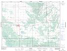
Maps showing Spruce Woods Wildlife Refuge, 14 - 10 - 16W, Manitoba
Spruce Woods Wildlife Refuge is a Conservation area located in 14 - 10 - 16W, Manitoba.
- Latitude: 49° 50' 22'' North (decimal: 49.8393999)
- Longitude: 99° 32' 28'' West (decimal: -99.5410999)
- Topography Feature Category: Conservation area
- Geographical Feature: Wildlife Refuge
- Canadian Province/Territory: Manitoba
- Location: 14 - 10 - 16W
- Atlas of Canada Locator Map: Spruce Woods Wildlife Refuge
- GPS Coordinate Locator Map: Spruce Woods Wildlife Refuge Lat/Long
Spruce Woods Wildlife Refuge NTS Map Sheets