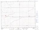
Maps showing J. Unrau Wildlife Refuge, 12 - 4 - 2W, Manitoba
J. Unrau Wildlife Refuge is a Conservation area located in 12 - 4 - 2W, Manitoba.
- Latitude: 49° 17' 16'' North (decimal: 49.2878000)
- Longitude: 97° 36' 56'' West (decimal: -97.6155999)
- Topography Feature Category: Conservation area
- Geographical Feature: Wildlife Refuge
- Canadian Province/Territory: Manitoba
- Location: 12 - 4 - 2W
- Atlas of Canada Locator Map: J. Unrau Wildlife Refuge
- GPS Coordinate Locator Map: J. Unrau Wildlife Refuge Lat/Long