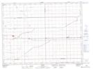
Maps showing W. Sessions Wildlife Refuge, 31 - 5 - 2W, Manitoba
W. Sessions Wildlife Refuge is a Conservation area located in 31 - 5 - 2W, Manitoba.
- Latitude: 49° 26' 6'' North (decimal: 49.4349999)
- Longitude: 97° 42' 29'' West (decimal: -97.7080999)
- Topography Feature Category: Conservation area
- Geographical Feature: Wildlife Refuge
- Canadian Province/Territory: Manitoba
- Location: 31 - 5 - 2W
- Atlas of Canada Locator Map: W. Sessions Wildlife Refuge
- GPS Coordinate Locator Map: W. Sessions Wildlife Refuge Lat/Long