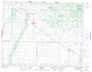
Maps showing John McPhail Wildlife Refuge, 3 - 19 - 24W, Manitoba
John McPhail Wildlife Refuge is a Conservation area located in 3 - 19 - 24W, Manitoba.
- Latitude: 50° 36' 21'' North (decimal: 50.6058000)
- Longitude: 100° 44' 1'' West (decimal: -100.7336000)
- Topography Feature Category: Conservation area
- Geographical Feature: Wildlife Refuge
- Canadian Province/Territory: Manitoba
- Location: 3 - 19 - 24W
- Atlas of Canada Locator Map: John McPhail Wildlife Refuge
- GPS Coordinate Locator Map: John McPhail Wildlife Refuge Lat/Long
John McPhail Wildlife Refuge NTS Map Sheets