Canada Topographic Maps

Swan-Pelican Wildlife Refuge Topo Maps

Topography maps and Latitude/Longitude Location

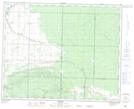
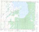
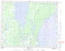
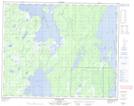
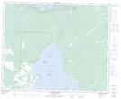
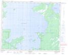
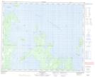
Maps showing Swan-Pelican Wildlife Refuge, 9 - 40 - 22W, Manitoba

Swan-Pelican Wildlife Refuge is a Conservation area located in 9 - 40 - 22W, Manitoba.

  • Latitude: 52° 25' 49'' North   (decimal: 52.4303000)
  • Longitude: 100° 34' 40'' West   (decimal: -100.5777999)
  • Topography Feature Category: Conservation area
  • Geographical Feature: Wildlife Refuge
  • Canadian Province/Territory: Manitoba
  • Location: 9 - 40 - 22W
  • Atlas of Canada Locator Map: Swan-Pelican Wildlife Refuge
  • GPS Coordinate Locator Map: Swan-Pelican Wildlife Refuge Lat/Long

Swan-Pelican Wildlife Refuge NTS Map Sheets

063C02 Renwer Topographic Map at 1:50,000 scale

063C07 Lenswood Topographic Map at 1:50,000 scale

063C08 Magnolia Lake Topographic Map at 1:50,000 scale

063C09 Kircro Lake Topographic Map at 1:50,000 scale

063C10 Pelican Rapids Topographic Map at 1:50,000 scale

063C15 Dawson Bay Topographic Map at 1:50,000 scale

063C16 Pelican Bay Topographic Map at 1:50,000 scale

063C Swan Lake Topographic Map at 1:250,000 scale

 
Buy Topographic Maps DVD
Newsletter Sign-up

Yes, I want to receive map store discounts.


Bookmark and Share