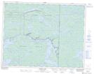
Maps showing Scotts Creek, 36 - 16 - 15E, Manitoba
Scotts Creek is a River located in 36 - 16 - 15E, Manitoba.
- Latitude: 50° 22' 28'' North (decimal: 50.3744444)
- Longitude: 95° 23' 50'' West (decimal: -95.3972222)
- Topography Feature Category: River
- Geographical Feature: Creek
- Canadian Province/Territory: Manitoba
- Location: 36 - 16 - 15E
- Atlas of Canada Locator Map: Scotts Creek
- GPS Coordinate Locator Map: Scotts Creek Lat/Long
Scotts Creek NTS Map Sheets