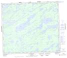
Maps showing Frederick Hall Lake, 73 - 8E, Manitoba
Frederick Hall Lake is a Lake located in 73 - 8E, Manitoba.
- Latitude: 55° 19' 10'' North (decimal: 55.3194444)
- Longitude: 96° 20' 57'' West (decimal: -96.3491666)
- Topography Feature Category: Lake
- Geographical Feature: Lake
- Canadian Province/Territory: Manitoba
- Location: 73 - 8E
- Atlas of Canada Locator Map: Frederick Hall Lake
- GPS Coordinate Locator Map: Frederick Hall Lake Lat/Long