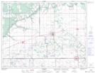
Maps showing Joe Ruttle Creek, 1 - 8 - 12 W, Manitoba
Joe Ruttle Creek is a River located in 1 - 8 - 12 W, Manitoba.
- Latitude: 49° 37' 50'' North (decimal: 49.6305555)
- Longitude: 98° 58' 38'' West (decimal: -98.9772222)
- Topography Feature Category: River
- Geographical Feature: Creek
- Canadian Province/Territory: Manitoba
- Location: 1 - 8 - 12 W
- Atlas of Canada Locator Map: Joe Ruttle Creek
- GPS Coordinate Locator Map: Joe Ruttle Creek Lat/Long