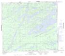
Maps showing Saunderson Island, 74 - 6E, Manitoba
Saunderson Island is a Island located in 74 - 6E, Manitoba.
- Latitude: 55° 23' 12'' North (decimal: 55.3866666)
- Longitude: 96° 34' 19'' West (decimal: -96.5719444)
- Topography Feature Category: Island
- Geographical Feature: Island
- Canadian Province/Territory: Manitoba
- Location: 74 - 6E
- Atlas of Canada Locator Map: Saunderson Island
- GPS Coordinate Locator Map: Saunderson Island Lat/Long
Saunderson Island NTS Map Sheets