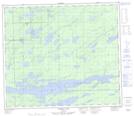
Maps showing Bottom End Lake, 73 - 1E, Manitoba
Bottom End Lake is a Lake located in 73 - 1E, Manitoba.
- Latitude: 55° 21' 53'' North (decimal: 55.3647222)
- Longitude: 97° 20' 38'' West (decimal: -97.3438888)
- Topography Feature Category: Lake
- Geographical Feature: Lake
- Canadian Province/Territory: Manitoba
- Location: 73 - 1E
- Atlas of Canada Locator Map: Bottom End Lake
- GPS Coordinate Locator Map: Bottom End Lake Lat/Long
Bottom End Lake NTS Map Sheets