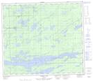
Maps showing Eye Island, 74 - 2E, Manitoba
Eye Island is a Island located in 74 - 2E, Manitoba.
- Latitude: 55° 25' 16'' North (decimal: 55.4211111)
- Longitude: 97° 10' 37'' West (decimal: -97.1769444)
- Topography Feature Category: Island
- Geographical Feature: Island
- Canadian Province/Territory: Manitoba
- Location: 74 - 2E
- Atlas of Canada Locator Map: Eye Island
- GPS Coordinate Locator Map: Eye Island Lat/Long
Eye Island NTS Map Sheets