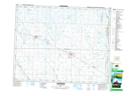
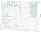
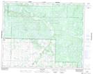
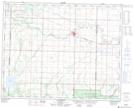
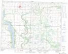
Maps showing Shellmouth-Boulton, 24 - 23 - 28W, Manitoba
Shellmouth-Boulton is a Other municipal/district area - miscellaneous located in 24 - 23 - 28W, Manitoba.
- Latitude: 50° 59' 35'' North (decimal: 50.9930555)
- Longitude: 101° 15' 29'' West (decimal: -101.2580555)
- Topography Feature Category: Other municipal/district area - miscellaneous
- Geographical Feature: Rural Municipality
- Canadian Province/Territory: Manitoba
- Location: 24 - 23 - 28W
- Atlas of Canada Locator Map: Shellmouth-Boulton
- GPS Coordinate Locator Map: Shellmouth-Boulton Lat/Long
Shellmouth-Boulton NTS Map Sheets
062K13 Langenburg Topographic Map at 1:50,000 scale
062K14 Inglis Topographic Map at 1:50,000 scale
062K15 Glen Elmo Topographic Map at 1:50,000 scale
062N02 Grandview Topographic Map at 1:50,000 scale
062N03 Roblin Topographic Map at 1:50,000 scale
062N04 Calder Topographic Map at 1:50,000 scale
062K Riding Mountain Topographic Map at 1:250,000 scale
062N Duck Mountain Topographic Map at 1:250,000 scale