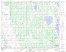
Maps showing Lagimodière Creek, 18-25-12-W, Manitoba
Lagimodière Creek is a River located in 18-25-12-W, Manitoba.
- Latitude: 51° 9' 29'' North (decimal: 51.1580555)
- Longitude: 99° 7' 53'' West (decimal: -99.1313888)
- Topography Feature Category: River
- Geographical Feature: Creek
- Canadian Province/Territory: Manitoba
- Location: 18-25-12-W
- Atlas of Canada Locator Map: Lagimodière Creek
- GPS Coordinate Locator Map: Lagimodière Creek Lat/Long
Lagimodière Creek NTS Map Sheets