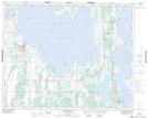
Maps showing Aimés Point, 29-30-30-16-W, Manitoba
Aimés Point is a Cape located in 29-30-30-16-W, Manitoba.
- Latitude: 51° 36' 14'' North (decimal: 51.6038888)
- Longitude: 99° 41' 29'' West (decimal: -99.6913888)
- Topography Feature Category: Cape
- Geographical Feature: Point
- Canadian Province/Territory: Manitoba
- Location: 29-30-30-16-W
- Atlas of Canada Locator Map: Aimés Point
- GPS Coordinate Locator Map: Aimés Point Lat/Long
Aimés Point NTS Map Sheets