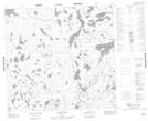
Maps showing Larivière Lake, 104-4-E, Manitoba
Larivière Lake is a Lake located in 104-4-E, Manitoba and has an elevation of 276 meters.
- Latitude: 58° 1' 32'' North (decimal: 58.0255555)
- Longitude: 96° 58' 25'' West (decimal: -96.9736111)
- Topography Feature Category: Lake
- Geographical Feature: Lake
- Canadian Province/Territory: Manitoba
- Elevation: 276 meters
- Location: 104-4-E
- Atlas of Canada Locator Map: Larivière Lake
- GPS Coordinate Locator Map: Larivière Lake Lat/Long
Larivière Lake NTS Map Sheets