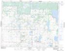
Maps showing Bottle Lake 61B, Manitoba
Bottle Lake 61B is a Indian Reserve located in Manitoba.
- Latitude: 50° 37' 47'' North (decimal: 50.6296999)
- Longitude: 100° 10' 34'' West (decimal: -100.1761000)
- Topography Feature Category: Indian Reserve
- Geographical Feature: Indian Reserve - Réserve indienne
- Canadian Province/Territory: Manitoba
- Atlas of Canada Locator Map: Bottle Lake 61B
- GPS Coordinate Locator Map: Bottle Lake 61B Lat/Long
Bottle Lake 61B NTS Map Sheets